True High-Resolution Panorama Exports from Matterport Spaces
Get every sweep as equirectangular panorama.
Precisely leveled and positioned as part of a coherent scan group.
Perfect for archiving, professional tour builders and complete data control.
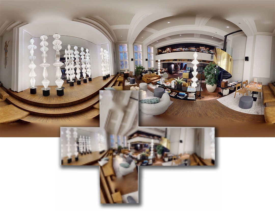
We extract complete panorama sets from Matterport spaces in their highest usable resolution and deliver them as standard image files.
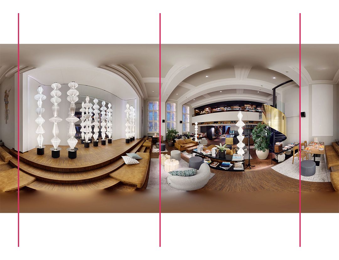
Every panorama is precisely leveled and positioned as part of a coherent scan group. Orientation (pitch, roll, heading) and relative positioning are embedded so that professional software can immediately interpret the spatial relationships correctly.
This service is designed for professionals who require full control over their 360° imagery outside the Matterport platform.
WHAT THIS SERVICE PROVIDES
-
High-resolution equirectangular panoramas in 8K, 12K, or true 16K
-
Accurate leveling based on capture data (no visual guesswork)
-
Group-based positioning so all scans align correctly relative to each other
-
Orientation data embedded in every file (pitch, roll, heading)
-
Standard JPEG files suitable for long-term storage and reuse
-
Optional native 4K cubemap faces for maximum image fidelity (16K Ultra Archive)
All deliverables are provided as downloadable files. No proprietary viewer, API access, or cloud service is required.
WHY THIS MATTERS
Matterport is an efficient capture and presentation platform, but it does not provide direct access to the underlying high-resolution panorama data in a form that can be freely reused.
This service restores access to that data and adds two critical qualities that are rarely available elsewhere:
-
True leveling – panoramas are corrected using capture orientation data, not visual estimation
-
Consistent positioning – all scans are spatially aligned as a group, not treated as isolated images
Together, this enables workflows that would otherwise require extensive manual correction or are simply not feasible.
TYPICAL USE CASES
The extracted panorama sets can be used for:
-
Creating virtual tours with tools such as Pano2VR, 3DVista, or similar software
-
Hosting tours independently, including offline or restricted environments
-
Preparing high-quality Street View workflows using third-party editors
-
Long-term archival of 360° documentation in standard, future-proof image formats
-
Construction and installation documentation before areas are closed or finished
-
Property handover documentation in commercial and institutional projects
- Cubemap outputs enable integration into advanced visualization pipelines and experimental 3D workflows
The delivered files remain usable regardless of future platform changes or subscription status.
FORMATS & FEATURES
Output Formats
High-resolution up to 16K. Equirectangular Panoramas or cubemap faces, delivered as captured.
Leveled Panoramas
Perfectly leveled panoramas with pitch and roll correction applied.
Ready for any viewer or archive use.
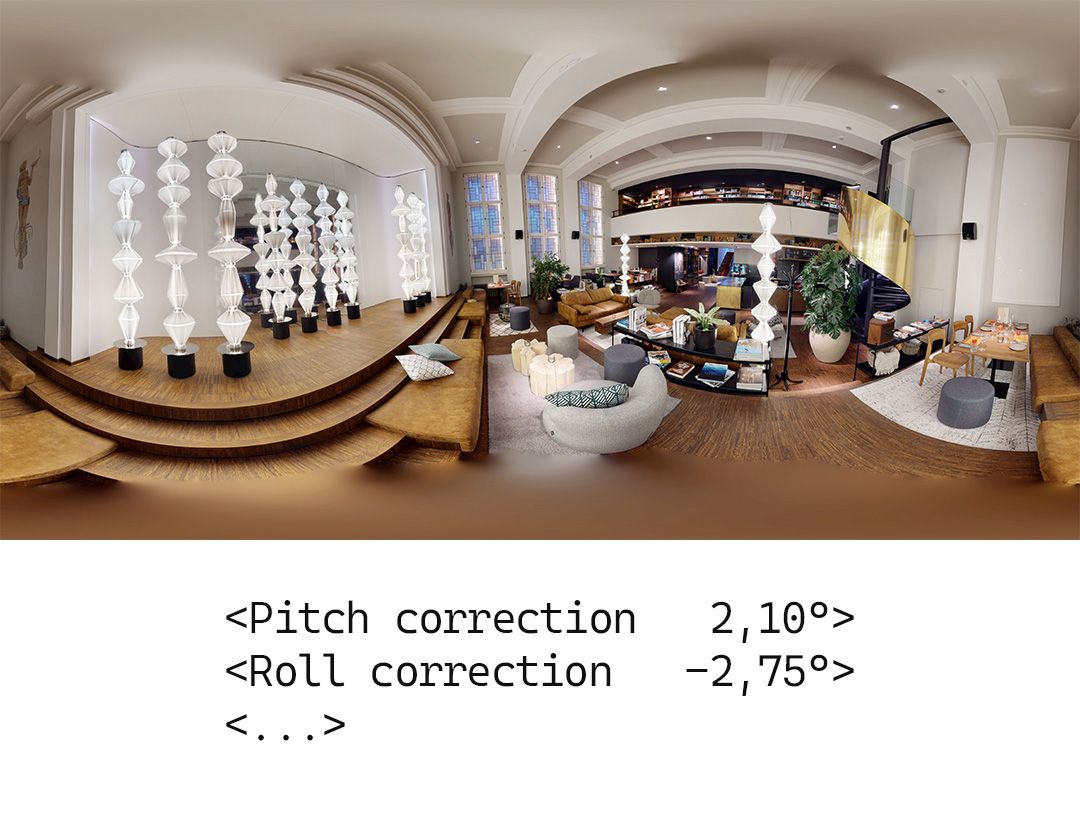
Metadata-Based Leveling
Orientation data embedded in metadata.
Displayed leveled in compatible tools without altering image data.
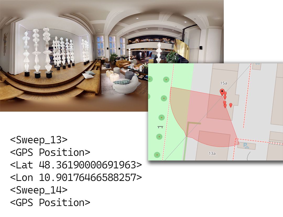
Spatial Positioning
Relative scan positions and heading orientation included.
Ideal for tour builders and Street View preparation.
IMAGE QUALITY AND RESOLUTION
Matterport internally operates on cube face imagery. Converting cube faces into equirectangular panoramas introduces a small and unavoidable amount of reprojection softness at extreme zoom levels.
This does not affect normal viewing or tour usage, but for applications that require maximum pixel-level detail, native cubemap faces represent the highest-quality output.
The 16K Ultra Archive combines both:
-
16K leveled panoramas for universal compatibility
-
Native 4K cubemaps for maximum detail preservation
Scan selection
Scan selection is allowed.
You may specify which scans from your Matterport project are included in processing.
Only the selected scans count toward your scan tier.
This allows you to exclude redundant or unnecessary scan points and remain within a lower pricing tier when appropriate.
HOW THE PROCESS WORKS
-
You place your order and select resolution and project size
-
You transfer a copy of the Matterport project to our processing account
-
Device compatibility is verified
-
The panorama sets are processed and packaged
-
You receive a download link with all deliverables
-
Project data is deleted after completion
Available Panorama Resolutions
Depending on your intended use, we provide different output resolutions.
All resolutions are generated from the same source data. The difference lies in file size, performance, and how the imagery can be used over time.
8K (8192 × 4096)
Well suited for Google Street View preparation and web-based tour platforms.
A balanced option that delivers solid image quality with good performance in most viewers.
12K (12288 × 6144)
A high-quality choice for professional virtual tours.
Noticeably sharper than 8K while still performant enough for most tour-building workflows.
16K (16384 × 8192) native resolution
Maximum resolution for archiving, documentation, and high-end virtual tours.
Designed for long-term use cases where detail retention and future compatibility matter.
Ready to get your panoramas?
Choose your resolution and processing options.
We take care of the technical workflow.
4K Cubefaces
Starting at $179
Optimized for Street View and web-based tours
- Standard Imagery (Equirectangular or Cubemap)
- Up to 8K output
Metadata leveled Panoramas
Starting at $229
High-quality resolution for professional virtual tours
- Standard Imagery (Equirectangular or Cubemap)
- Up to 12K output
Image Leveled Panoramas
Starting at $279
Maximum resolution for archiving and long-term documentation
- Standard Imagery (Equirectangular or Cubemap)
- Up to 16K output
Professional Bundle: 12K/8K Panoramas
Starting at $179
Optimized for Street View and web-based tours
- Standard Imagery (Equirectangular or Cubemap)
- Up to 8K output
Enterprise Bundle: 16K/8K Panoramas + 4K Cubefaces
Starting at $229
High-quality resolution for professional virtual tours
- Standard Imagery (Equirectangular or Cubemap)
- Up to 12K output
4K Cubefaces Extraction - Project Size
Select the project size based on the number of scans in your Matterport space.
Each option includes the 4K cubeface extraction. 6 files per scan.
Metadata Leveled Panoramas - Resolution Selection
Select the project size based on the number of scans in your Matterport space.
Each option includes the full 8K panorama extraction.
Image Leveled Panoramas - Resolution Selection
Select the project size based on the number of scans in your Matterport space.
Each option includes the full 8K panorama extraction.
Metadata leveled 8K - Project Size Selection
1—100 scans
$179
Tier 1
- 8K Resolution Panoramas
- Pitch and Roll Correction Metadata
- Positioning Metadata
101—250 scans
$229
Tier 2
- 8K Resolution Panoramas
- Pitch and Roll Correction Metadata
- Positioning Metadata
251—500 scans
$299
Tier 3
- 8K Resolution Panoramas
- Pitch and Roll Correction Metadata
- Positioning Metadata
501—750 scans
$379
Tier 4
- 8K Resolution Panoramas
- Pitch and Roll Correction Metadata
- Positioning Metadata
751—1000 scans
$429
Tier 5
- 8K Resolution Panoramas
- Pitch and Roll Correction Metadata
- Positioning Metadata
Metadata leveled 12K - Project Size Selection
Select the project size based on the number of scans in your Matterport space.
Each option includes the full 8K panorama extraction.
Metadata leveled 16K - Project Size Selection
Image leveled 8K - Project Size Selection
Image leveled 12K - Project Size Selection
Image leveled 16K - Project Size Selection
Professional Bundle - Project Size Selection
What exactly do I receive?
Are the panoramas perfectly leveled?
What does “relative positioning” mean?
Can I choose which scans are processed?
Why do 16K panoramas sometimes look slightly softer at extreme zoom?
Which cameras and projects are supported?
How long does processing take?
What happens to my data after delivery?What happens to my data after delivery?What happens to my data after delivery?
DATA HANDLING
Project data is used exclusively to generate the ordered deliverables. After delivery, all project data is deleted in accordance with our data handling policy.
You are responsible for ensuring that you have the right to submit the project for processing.
CONTACT
If you have questions about scan selection, project size, or device compatibility, please contact us before placing an order.
